My first day in Mali was nothing like I had imagined. Neither had I imagined that any road, dirt road or trail that make it onto a Michelin 1:4 000 000 scale map could be as small as the forest trail I ended up on. And I had not gotten further than 20 km into Mali when this dawned on me.
Based on the Michelin map, I had plotted a route on the Open Street Map in my GPS. It started in the town of Kenieba just across the border from Senegal and continued via Kassama, Koundian, Manantali and on to the city of Kita. It looked like the most straight forward route towards the capital Bamako and it never even entered my mind that this route would take me into an adventure that was nowhere near my agenda when I set out on this journey some five months ago.
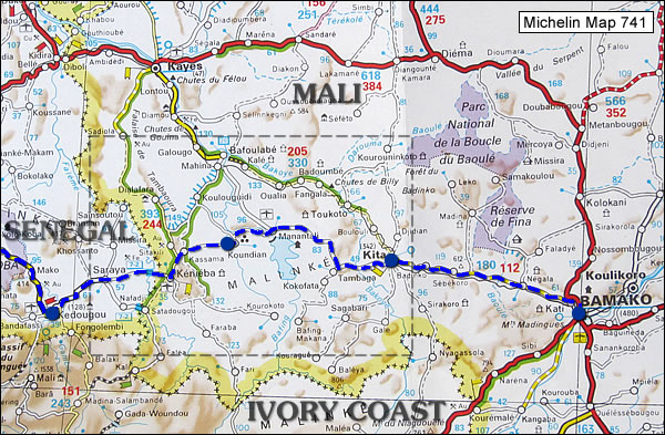
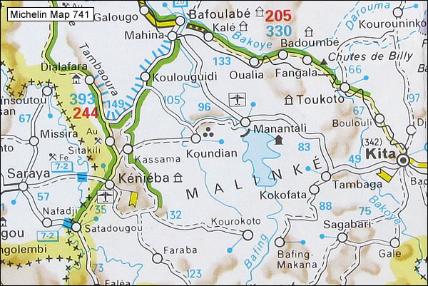
The Michelin map 741 (Edition 4, 2012) captures the reality fairly well. The road between Saraya and Kenieba was paved and in good condition. Most av the part between Kenieba and Koundian consisted of a small single-track trail. Koundian to Manantali was a rough dirt road and between Manantali and Tambaga it was a good but corrugated dirt road with paved parts where rain water affects the road. Tambaga to Kita offered a very nice paved road.
I had driven from the town of Kedougou in Senegal this morning and it was already after noontime when I started out in the direction towards Kassama. I had a brief thought of making an early stop in Kenieba but decided it was a bit too early so I drove on. After passing a mine the dirt road quickly turned into a single track dirt trail. I should have realized already here that this was not just a temporary passage and that it would continue as a small dirt trail for a long time but initially it was smooth riding and the landscape was fantastic with a vertical, craggy rock face closing in on my right hand side.
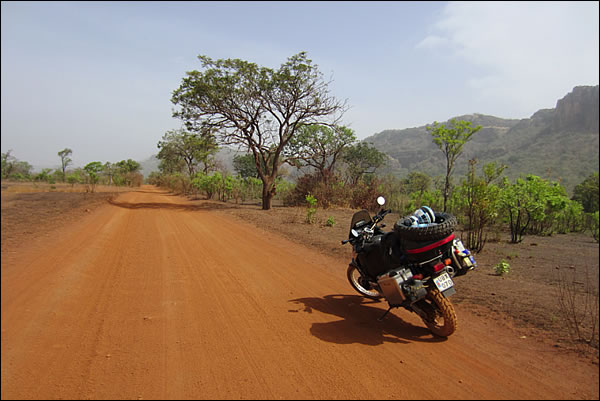
I should have sensed that trouble was coming my way when I saw something that looked like a hair pin curve on the GPS. A hair pin curve either takes you uphill or downhill but I couldn’t pair this hair pin curve with the rock face to my right. How could a small single track trail ascend such an obstacle? A short distance before it started uphill the smooth dirt trail abruptly turned into a sort of surface I had never driven on before: Rocks. Big rocks.
The rocks completely covered the trail and kept doing so for more than a kilometer. Once I had entered the rocks I could not stop. If I would have stopped at the wrong place I might not have been able to get going again. To turn around was impossible. There was just no way I could have turned the heavy bike around in this terrain, so the only thing I could do was to keep the bike rolling until I came to a plane surface. It was not really rolling, more like jumping and bumping over the rocks. I clung on to the handlebars the best I could and hoped that this brutal treatment wouldn’t harm the bike.
When I reached the hair pin curve I was surprised to enter a short stretch of flat concrete, a certain sign that this trail had once been some kind of road but not anymore. This was also a welcome break in the onslaught of the rocks. The cooling fan, which kicks in when the liquid cooling system doesn’t get enough wind to cool the engine, was running like mad. It was 35 degrees in the scorching sun and the sweat was pouring inside my helmet and my riding clothes as I brought the bike to a stop. My heart was pounding hard.
For a second I could admire the hazy views from this elevated position but my thoughts soon returned to my current situation. What to do now? For how long would these rocks continue? One thing I knew for sure: I had just barely crossed these rocks going uphill, taking them on in a downhill slope seemed even more difficult. I immediately crossed that option off my short list of alternatives.
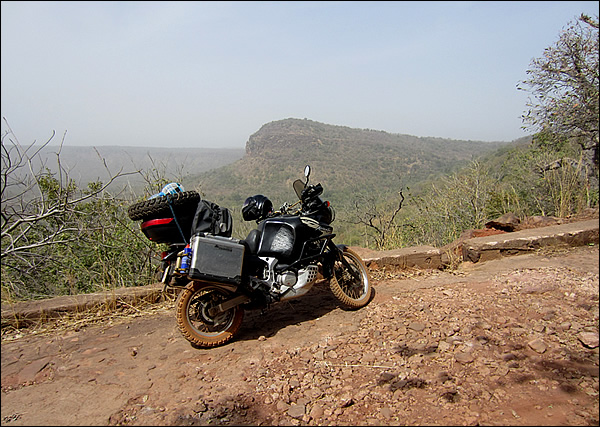
At the hair pin curve on even surface. I do not have any photos of the rocks as I couldn't stop in this section.
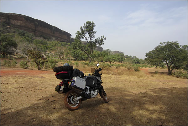
The rocks continued a little bit further until I came up on the plateau above the rock face. Here the trail returned to a smooth surface and a heart-pounding experience turned into a pleasant ride in fabulous natural scenery. I soon came to Kassama, a truly beautiful village of round adobe houses with pointy grass roofs in an equally beautiful setting with more rock faces on one side and a green forest on the other.
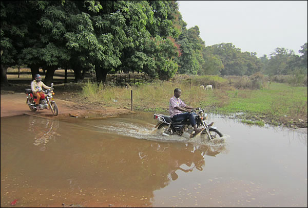
This was the biggest of very few water crossing along this route (in the village of Kassama).
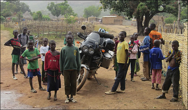
Of course, a bunch of kids wanted to see how the toubab fared across the water.
Afterwards I wished I would have spent the night here but I kept driving for another two and a half hours along the same single track trail. From here on there were no major difficulties. There were a few rocky places but nothing like the initial hair pin slope. There was a minor water crossing at the Kassama village but after that only small puddles. Bigger creeks were crossed on crumbling concrete bridges, also signs that this trail had had a previous life as a road.
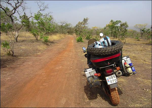
I couldn’t believe that I was driving on this little trail only a few hours after entering Mali. How did this happen? I had planned for a dirt road, maybe a bad dirt road but nothing like this. The trail was not bad, only very small. Judging by the tracks in the sand there were only two-wheeled vehicles using this route nowadays. I would not rule out that one or another 4x4 would get through as I know that local people in these parts of the world has a different concept of what is possible than we do in the western world, but it is definitely not done on a regular basis. Some stretches of the trail were so narrow that a car would have to push through the bushes to get pass.
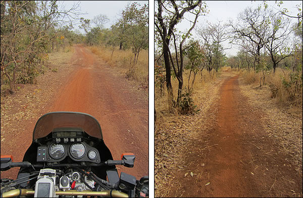
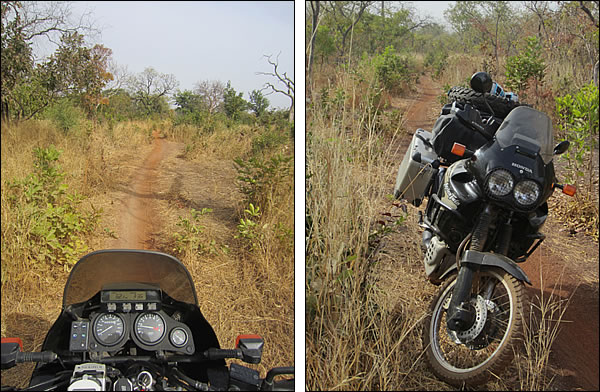
Short difficult passages were mixed with long stretches of pure happiness.
It was five o´clock when I reached a sizeable village that I was told was called Nanufarra, or something similar. By now I was getting really tired and decided to call it a day. An old man let me put my tent up next to his little house inside a lager compound. The local school was just next to it and it didn’t take long before a whole bunch of kids arrived to have a look at the toubab and his machine. Once they had arrived they didn’t want to leave. They only stood and stared at me and it didn’t seem like they would ever get tired of this. A few adult women came by to bluntly ask for money which I ignored. Finally my host got the kids to leave so I could cook my food in peace.
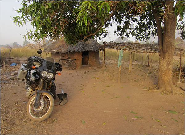
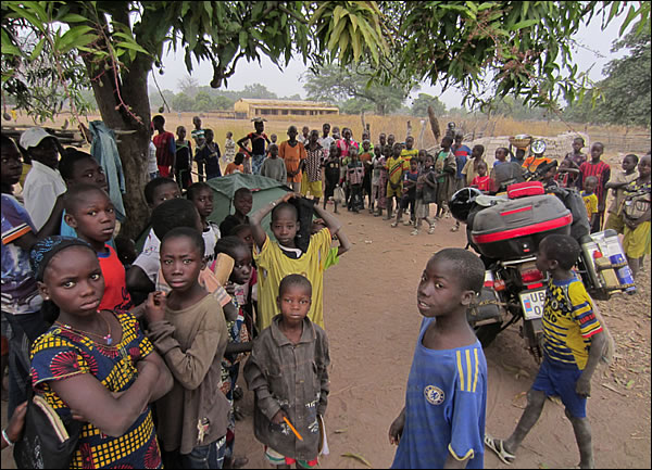
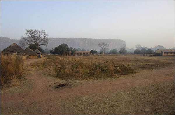
The following morning was fresh, only 15 degrees in the air. The locals had put on big, heavy coats and seemed to be freezing. I packed up my camp and managed to escape before too many children had arrived for another staring session with the toubab. The trail continued in the same character as the previous day with bushes close to the elbows and a few harder sections (like the downhill stone bed below) mixed with long bits of nice dirt trail, all in an amazing scenery.
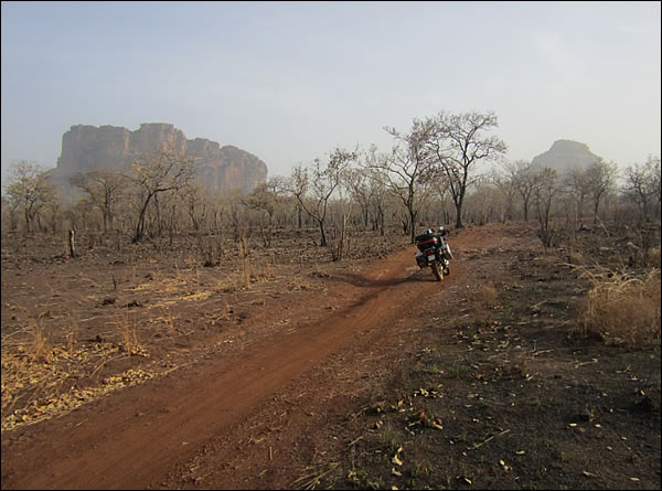
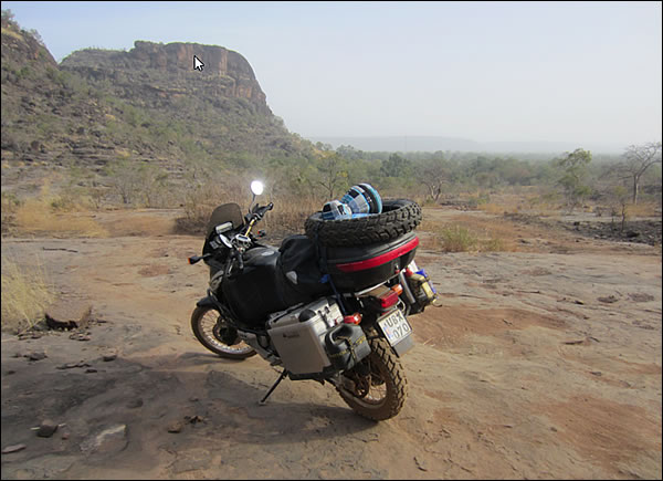
When I reached the village of Koundian the trail turned into a road trafficked by cars but even here the going was slow with a few tricky parts. In every village I passed the people waved and greeted me in a friendly manner.
Many of the houses in this area were built on a ring of rocks with the floor raised above the ground. This may work as ventilation to keep the house cool but it would also keep the house dry during rains.
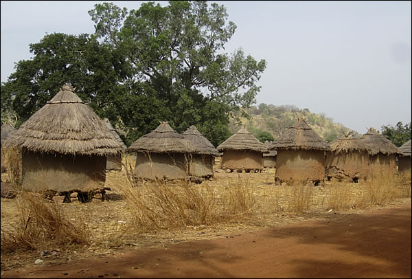
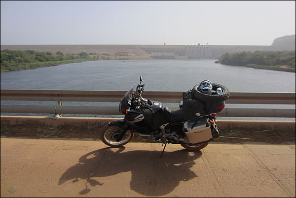
After this very primitive environment it came as a minor chock when I reached Manantali where a huge hydro-electric dam was built across the Bafing River. This river later turns into the Senegal River which hits the Atlantic ocean at St Louis on the border between Mauritania and Senegal. From here on I was back on "safe" ground and a regular dirt road took me to Tambaga where a good paved road led to Kita.
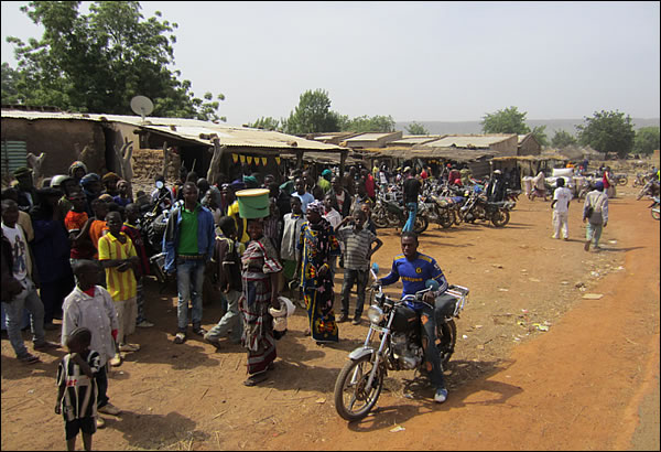
Market somewhere between Manantali and Tambaga.
I was back to somewhat civilized parts after a very memorable journey over two days. Honestly, before I set out on this journey and even only a few weeks ago, I did not think that I, with limited motorcycle experience and a big and heavy bike could do this kind of driving. During this journey I have slowly improved my driving skills and gotten used to the sheer weight of the bike but it is the last few weeks that has really widen my horizons of what is possible.
I have driven on narrow trails eroded with deep ruts, successfully passed minor water crossings, with difficulty managed large rocks and I feel more and more comfortable in the sand. The major road condition that I have yet to be exposed to and that concerns me a lot is mud. I have not driven in rain since I crossed the Pyrenees but sooner or later the rain will catch up with me and I can't say that I'm looking forward to it.
One thing is for sure: If I would stick to roads that are safely within my comfort zone, then I would never improve my driving skills and I would miss out on a lot of adventure. Many times it is better not to know what is in store for you behind the next curve and sometimes you need to be forced to challenge yourself in order to get over the fears of the unknown.
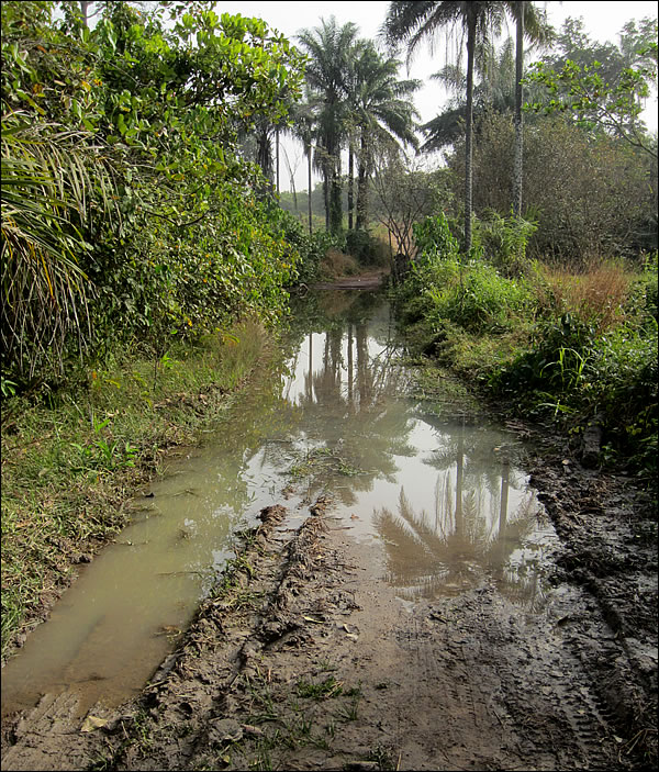
I am a conservative risk taker by nature but I like to push my limits, little by little. Something I really dislike is turning back along the same route I came but I will do so if I judge the obstacle to be too great which happened when I was faced with this water/mud crossing a couple of weeks ago in Guinea-Bissau. This is not heavy adventure bike territory.

/AB
|


